South Island Day Treks
visited: Nov 2019🟢 Easy: 0–50 m per km
🟡 Moderate: 50–100 m per km
🟠 Difficult: 100–150 m per km
🔴 Challenging: 150–225 m per km
⚫ Expert: 225+ m per km
Note: I use elevation gain per kilometre as a baseline, but I’ll bump a rating up if the track gets tricky — think roots, loose scree, uneven rocks, or exposed sections. Steepness is only part of the story.
New Zealand is known for its incredible outdoor spaces; the mountains almost beg to be hiked, and who are we to deny them? If your schedule has the time for it, consider taking on one of the country’s “Great Walks”, a series of multi-day trails with world famous views.
If you find yourself short on time and unable to head out on a multi-day hike, fear not, New Zealand had tons of rewarding day hikes. This list is filled with a selection of South Island treks, perfect for more spontaneous, game-time decisions.
Remember that while hiking in the mountains, weather can change quickly, so be prepared for all seasons, be sure to pack appropriately for the terrain and bring plenty of food and water.
→ New to hiking? Start here: Hiking 101. Learn how to choose trails, hiking terms, and what to pack (without overdoing it).
Isthmus Peak
Time: 5-7 hour return
Difficulty: difficult
Type: out-and-back
Distance: 15.8 kilometres
Elevation Gain: 1,155 metres
In the Wanaka area, Roy’s Peak gets all the attention, but Isthmus Peak is arguably more impressive. While Roy’s Peak overlooks Lake Wanaka, Isthmus gets sprawling views of both Lakes: Wanaka and Hawea. Only a 25 minute drive from town, this challenging hike is worth every switch back and incline.
The path leads through some private-owned farmland, so be sure to respect the posted signage: stay on the path, latch gates behind you, and leave the animals to their own devices.
Be prepared for all weather and wear proper footwear. When I visited we had sunshine, rain and snow in the 3 hours it took for the ascent!
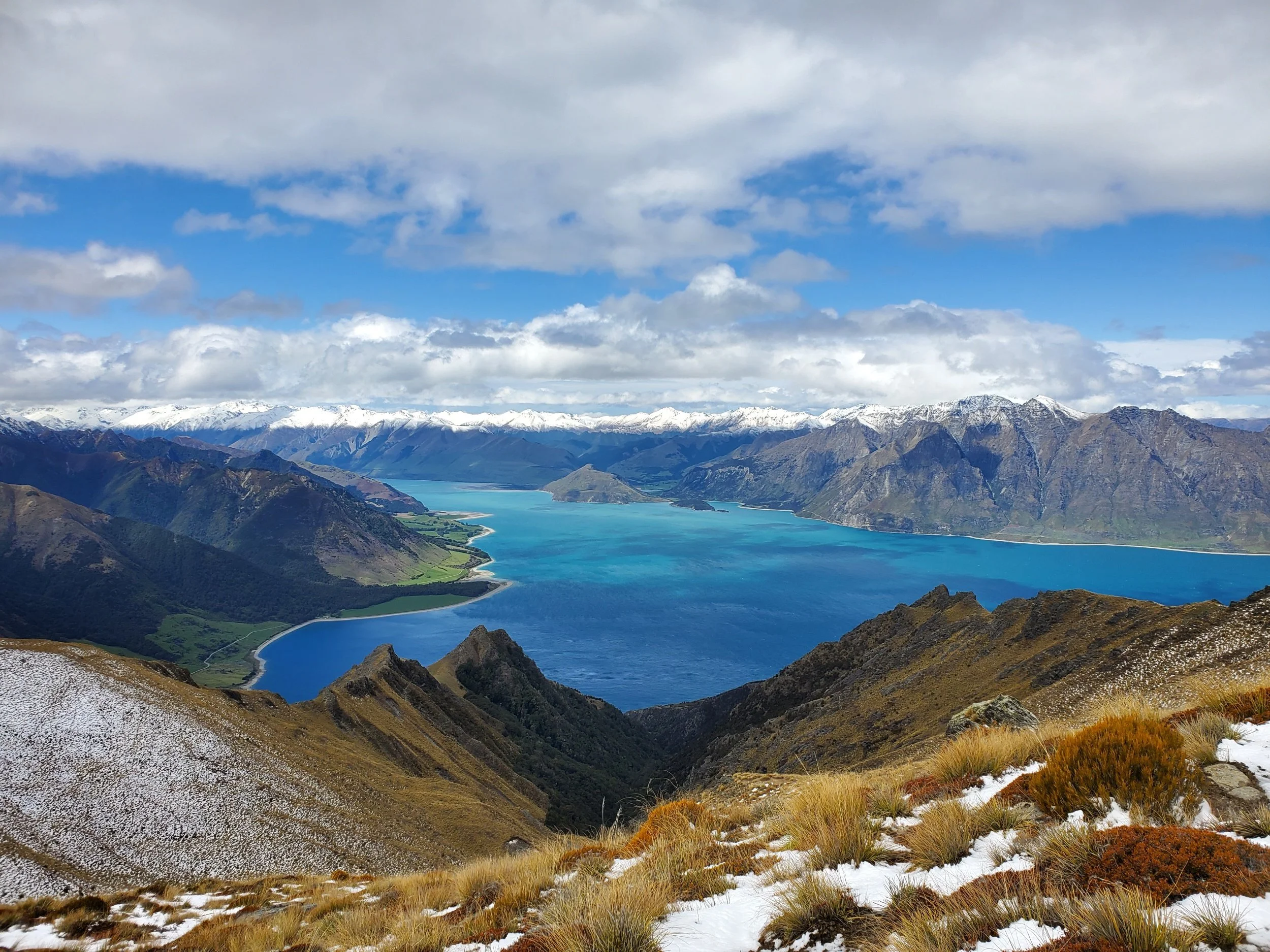
View from top of Isthmus Peak toward Lake Hawea
Roy’s Peak*
One of the most well-known day hikes of the South Island, and for good reason. The viewpoint offers incredible views of snow-capped mountains and the beautiful Lake Wanaka below. A popular choice for sunrise hikes, the hike requires a fair bit of effort, and you could easily experience all four seasons on your way up, so pack accordingly. There is little to no coverage on the path, meaning you will constantly be exposed to incredible views as well as the elements!
Time: 6 hour return
Difficulty: difficult
Type: out-and-back
Distance: 15.9 kilometres
Elevation Gain: 1,284 metres
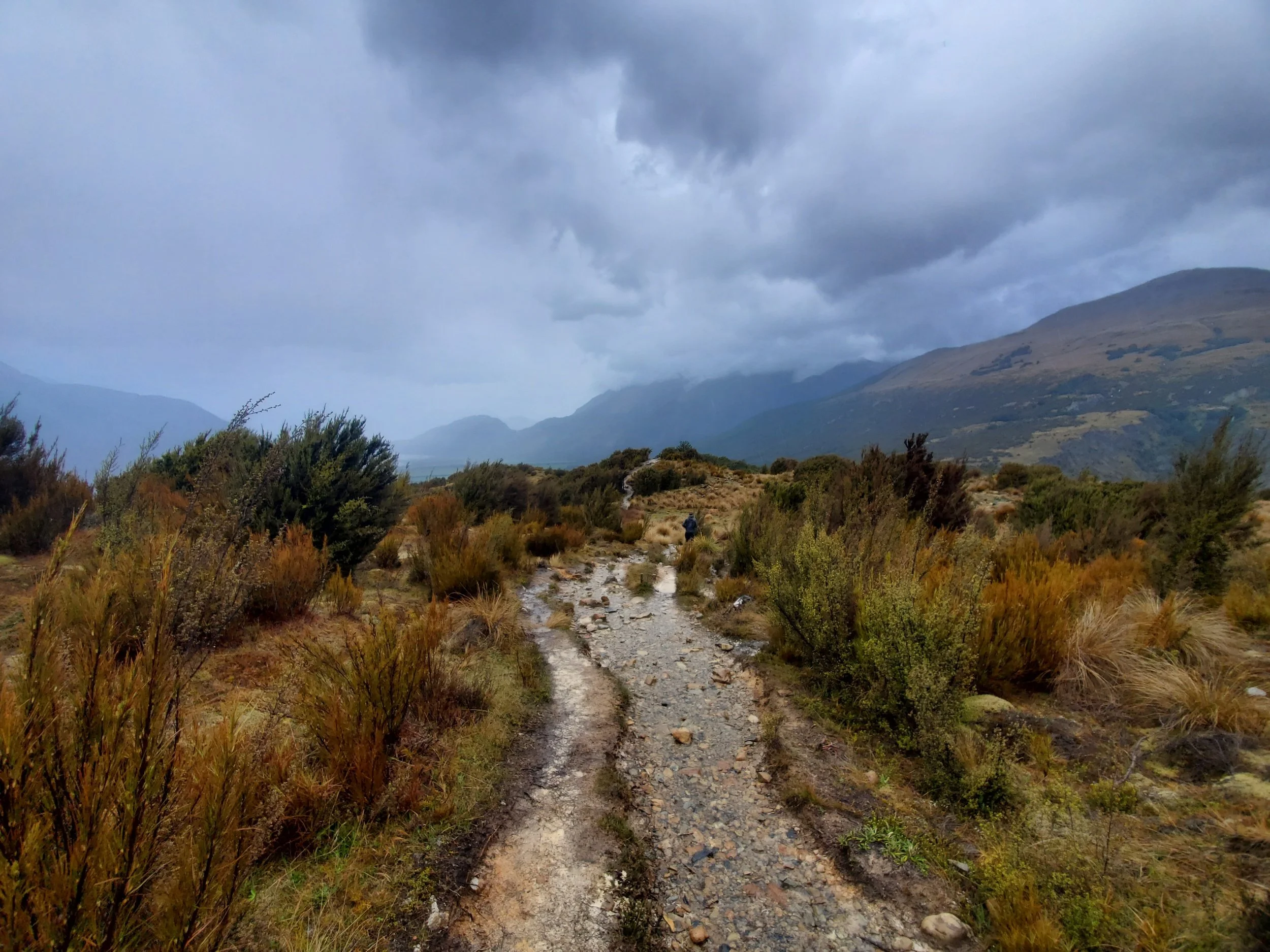
Walking along a ridge on Bealy Spur trail
Bealy Spur
Time: 4.5-5 hour return
Difficulty: moderate/difficult
Type: out-and-back
Distance: 12.1 kilometres
Elevation Gain: 641 metres
One of the easier hikes in the area, but it still makes you work for it. A steady uphill climb across root covered dirt trails, with views opening up near the top into the valleys below. You’ve reached the turn-around point once you arrive at the Bealy Spur Hut – a small, 6 bunk hut with a hearth – you can stay the night here without reservations if you wish. Many people continue on to longer hikes from here.
Be prepared for muddy sections, especially if there’s been rain recently.
Hooker Valley Walk
Time: 2-3 hour return
Difficulty: easy
Type: out-and-back
Distance: 10.8 kilometres
Elevation Gain: 214 metres
A great place to stretch your legs, in the midst of some exceptional mountain views. The paths are well maintained, though they can be a little slippery in rainy weather. It’s a very popular track, so you might be with some crowds – especially during peak seasons. You’ll cross suspension bridges and boardwalks, arriving at Hooker Lake with Mt Cook towering in the background. The perfect blend of gorgeous views and light work.
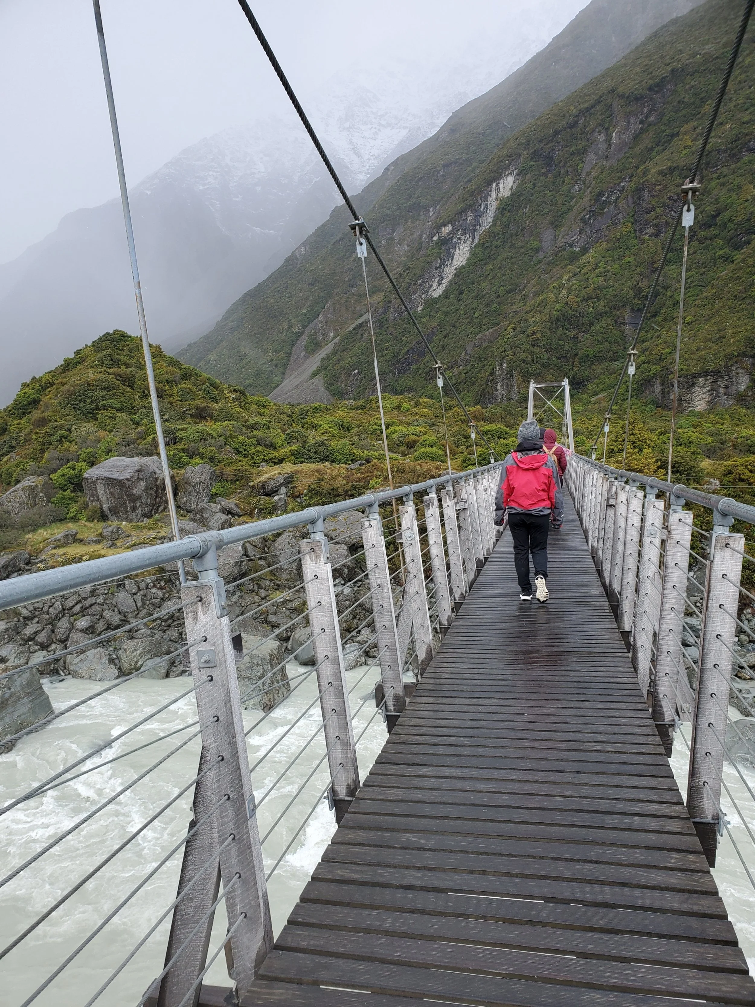
Crossing a suspension bridge in the Hooker Valley
Taking a break just past Sealy Tarns
Sealey Tarns
Time: 3-3.5 hour return
Difficulty: difficult
Type: out-and-back
Distance: 5.3 kilometres
Elevation Gain: 546 metres
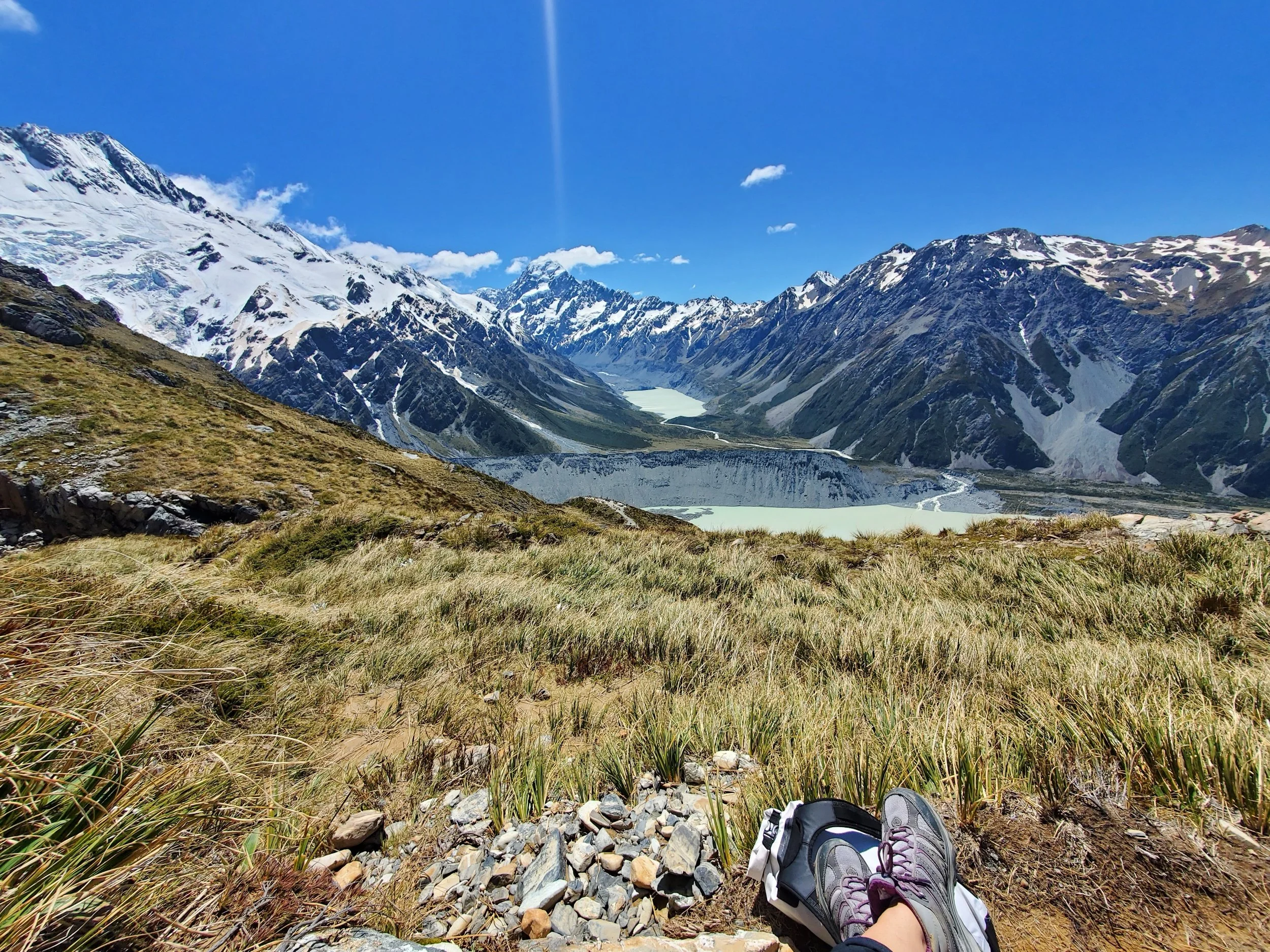
A “short” but not so easy hike. In my opinion, anything with leagues of stairs is a type of torture not intended for the weak – give me rock scrambles over stairs anyday! Despite the torture, the views are worth every step. Located at the top of 2,200 stairs, the Sealy Tarns Viewpoint looks over two tarns (small mountain lakes) with an unforgettable mountainous backdrop. From here you can opt to head back down or continue up to the Mueller Hut.
Mueller Hut
Time: 6-7.5 hour return
Difficulty: difficult/challenging
Type: out-and-back
Distance: 9.7 kilometres
Elevation Gain: 1,056 metres
A challenging hike, but with views that are well worth the effort. Beginning at the White Horse Hill Campground parking lot, and following up toward Sealy Tarns by way of 2,200 steps, it then continues along rock scrambles and avalanche trails. The hike can either be done as an out-and-back or the beginning of a longer adventure. Enjoy the views of snow-capped mountains sprawling through the National Park. Listen for the loud cracks of avalanches in the distance and take in the powerful magic of the mountains.
Make sure you have the proper equipment and only attempt during good weather. There are hiking outfitters in Mount Cook Village if you need to rent anything (ie spikes, poles, gaiters).
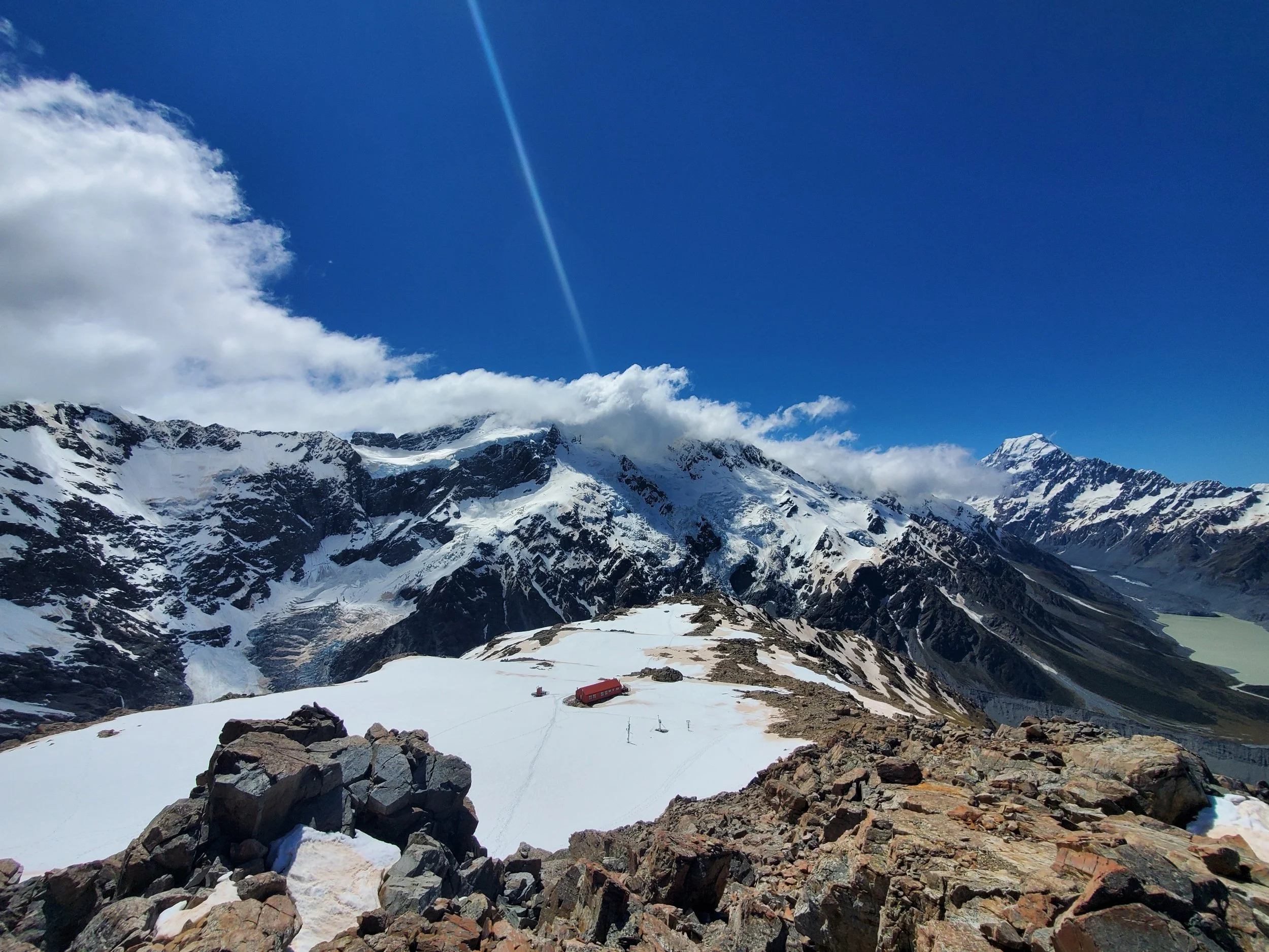
View from summit above Mueller Hut in Mount Cook National Park
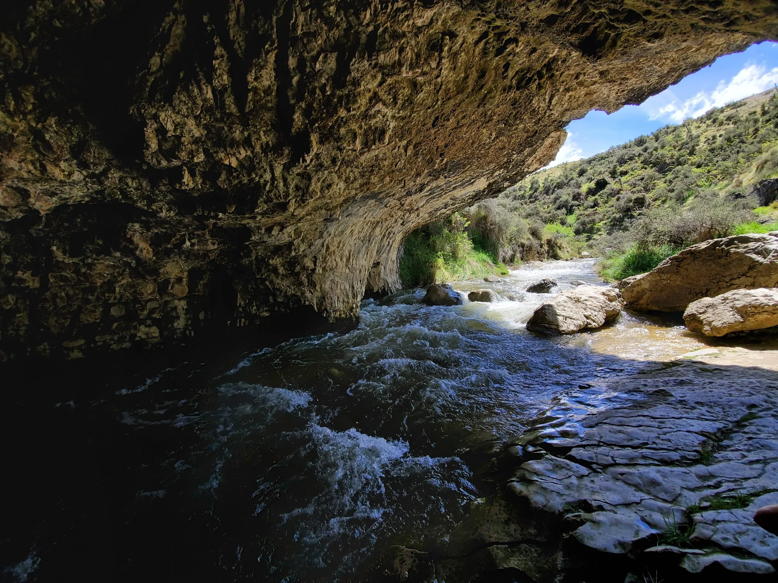
Inside one of the caves
Castle Hill/Cave Stream Walk
Time: 30 minute-1 hour return
Difficulty: easy
Type: loop
Distance: 1 kilometre
Elevation Gain: 40 metres
A well maintained loop path with a few some steeper stretches. It’s a less busy trail, with caving opportunities. The beauty of this walk is unique from the others on this list. Even just looking into the caves from where daylight still shines is a cool experience.
If you do plan to explore the caves, follow the posted safety guidelines and arrive properly equipped.
Lake Tekapo Peninsula Walk
Time: 1-1.25 hour return
Difficulty: easy
Type: loop
Distance: 5.3 kilometres
Elevation Gain: 122 metres
If you’ve been in the car for a few hours (or even if you haven’t) this walk through fields with sheep grazing and incredible views is the perfect place to stretch your legs while keeping things casual. The views of the glacier fed Lake Tekapo lined with lupins and a backdrop of endless mountains almost don’t look real.
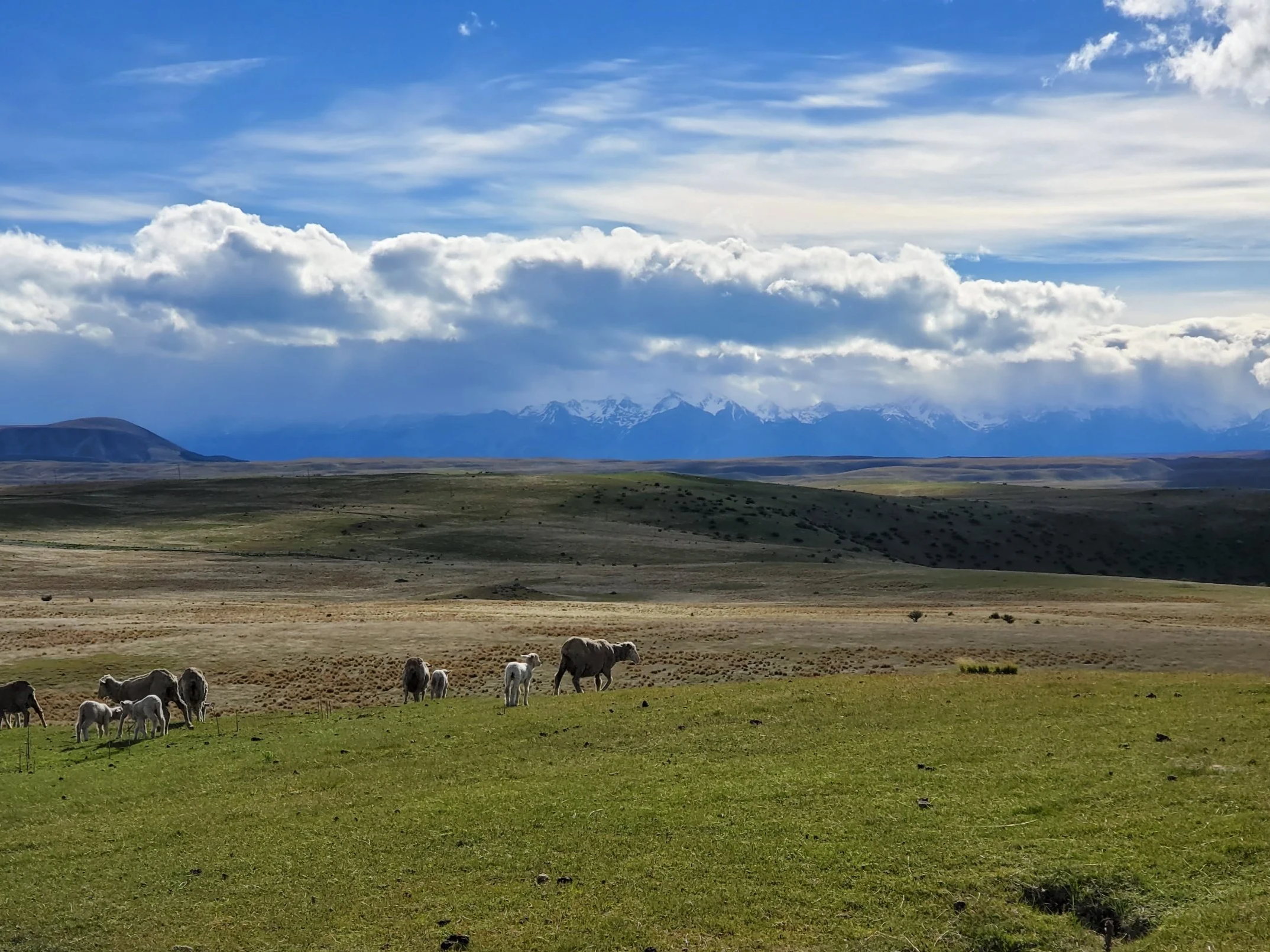
Lake Tekapo Peninsula Walk
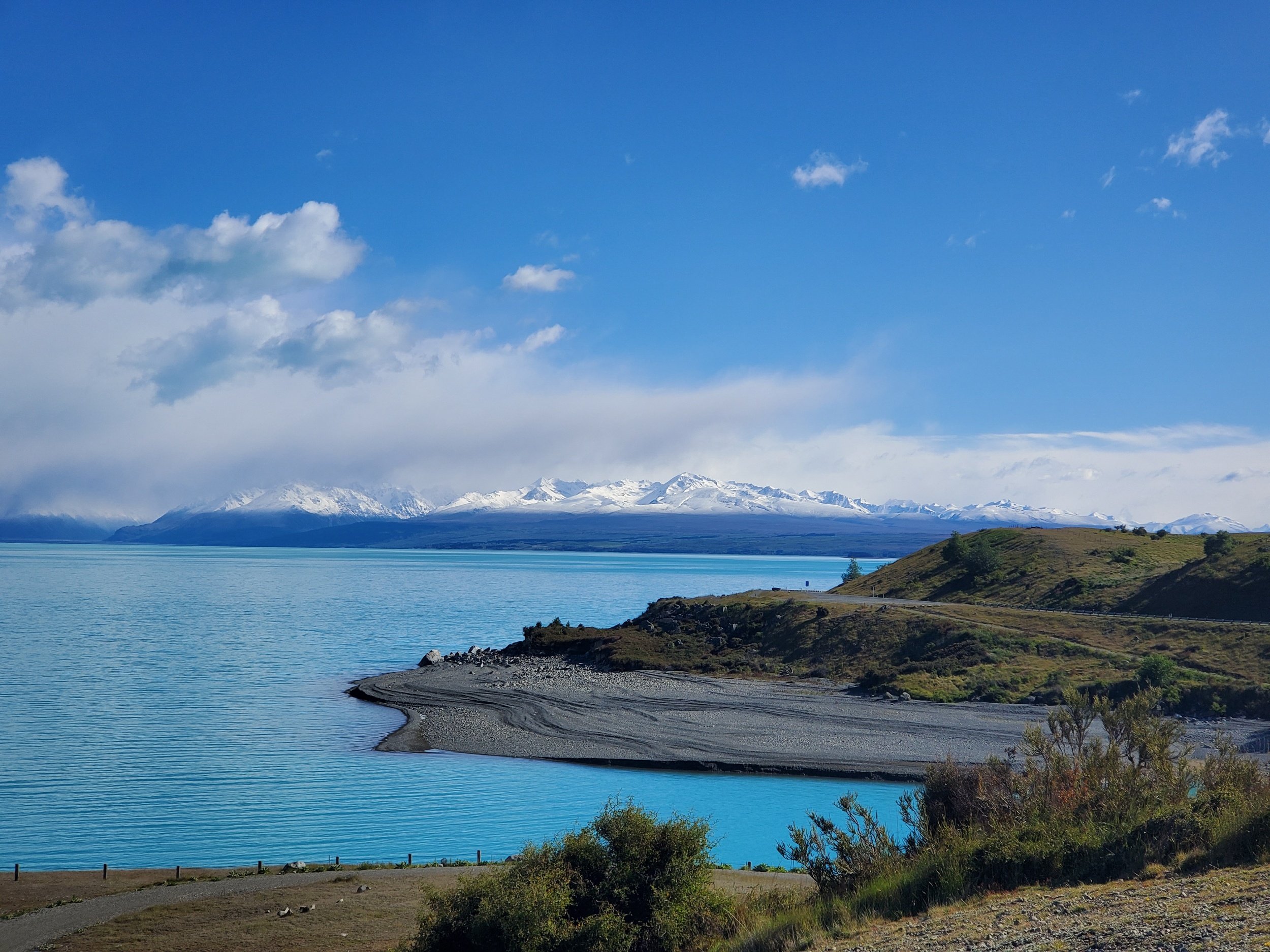
Lake Pukaki
Lake Pukaki Shoreline Walk (Alps 2 Ocean Trail)
Time: as long as you want
Difficulty: easy
Type: out-and-back
Distance: up to 30 kilometres
Elevation Gain: 100 metres
This another one of those “low-effort-high-reward” kind of trails; a walk more than a hike. Following along the edge of the turquoise, glacier-fed Lake Pukaki, the trail has views of Mount Cook and the other mountains of the National Park lining the horizon. The perfect sunset stroll if you’re staying the night at the campsite there (my favourite campsite in a 3 week trip).
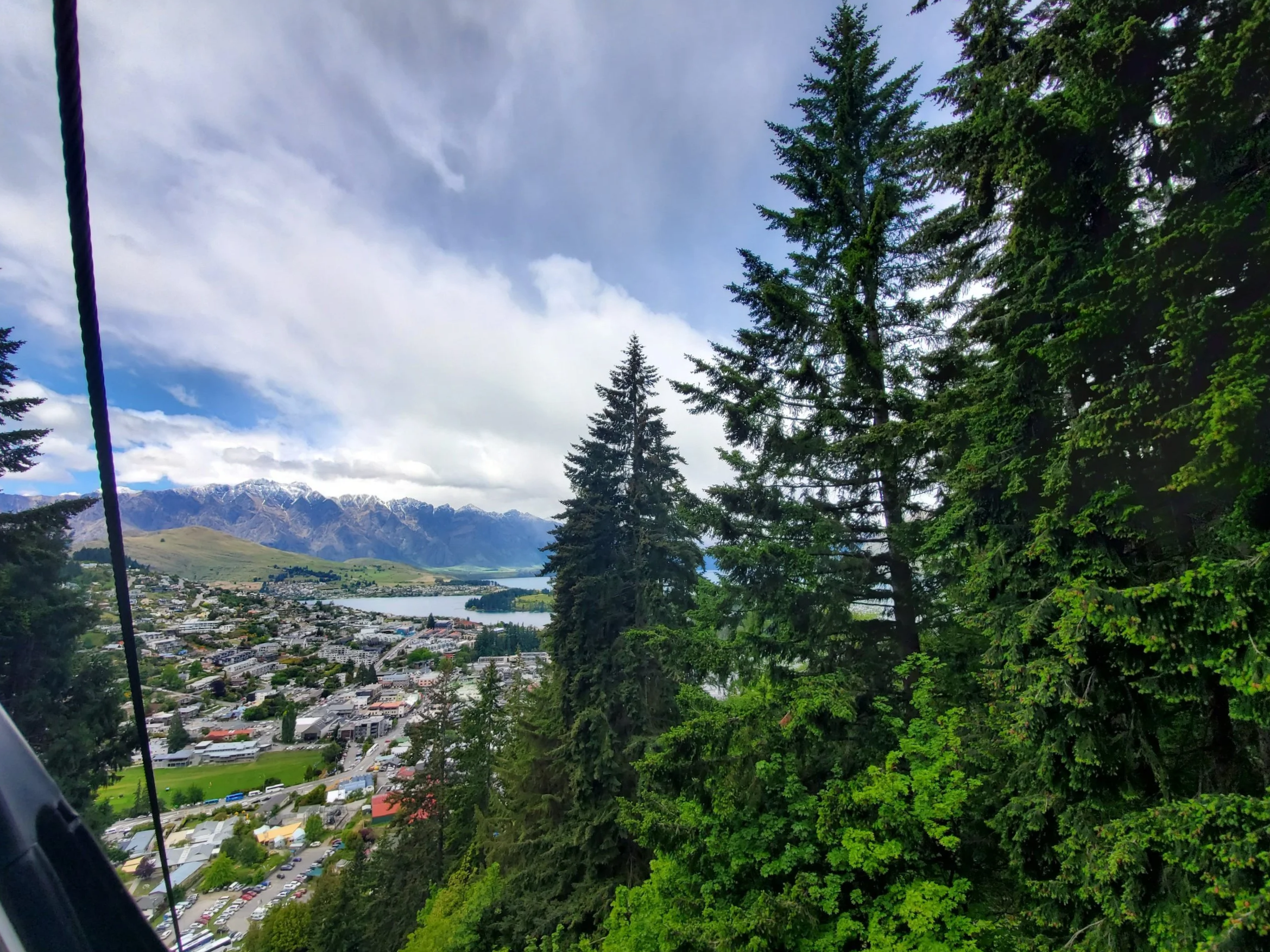
Ben Lomond (via Skyline Gondola)
Time: 6-8 hour return
Difficulty: difficult
Type: out-and-back
Distance: 10.8 kilometres
Elevation Gain: 1,011 metres
Ben Lomond is a conveniently located hike, accessible on foot if you’re staying in Queenstown. There are multiple access points to start the hike, the most recommended being the gondola station trailhead at the top of Brecon Street. If you would prefer, you can take the gondola up and begin from the top station. This rating is made based on taking the gondola up; if you choose to forgo it, add another 400 m of moderate incline elevation. After reaching the saddle, the hike gets significantly steeper until the summit. All that effort will be rewarded with some views of the Remarkables (the name is fitting) and the surrounding landscape.
Ben Lomond Skyline Gondola