North Island Day Treks
visited: nov 2019🟢 Easy: 0–50 m per km
🟡 Moderate: 50–100 m per km
🟠 Difficult: 100–150 m per km
🔴 Challenging: 150–225 m per km
⚫ Expert: 225+ m per km
Note: I use elevation gain per kilometre as a baseline, but I’ll bump a rating up if the track gets tricky — think roots, loose scree, uneven rocks, or exposed sections. Steepness is only part of the story.
Compared to the South Island, its northern counterpart isn’t mountainous, but that doesn’t mean it doesn’t have some spectacular hikes for its visitors. Plenty of them can be completed in a day or afternoon, allowing for a little low-commitment spontaneity.
Whether you’re searching for trails with sweeping ocean vistas, volcanic terrain, enchanting forests, or perhaps a filming location or two, the North Island delivers in droves.
Here’s a breakdown of the hikes I did on the North Island, and the ones I have on my list for next time… there will be a next time!
→ New to hiking? Start here: Hiking 101. Learn how to choose trails, hiking terms, and what to pack (without overdoing it).
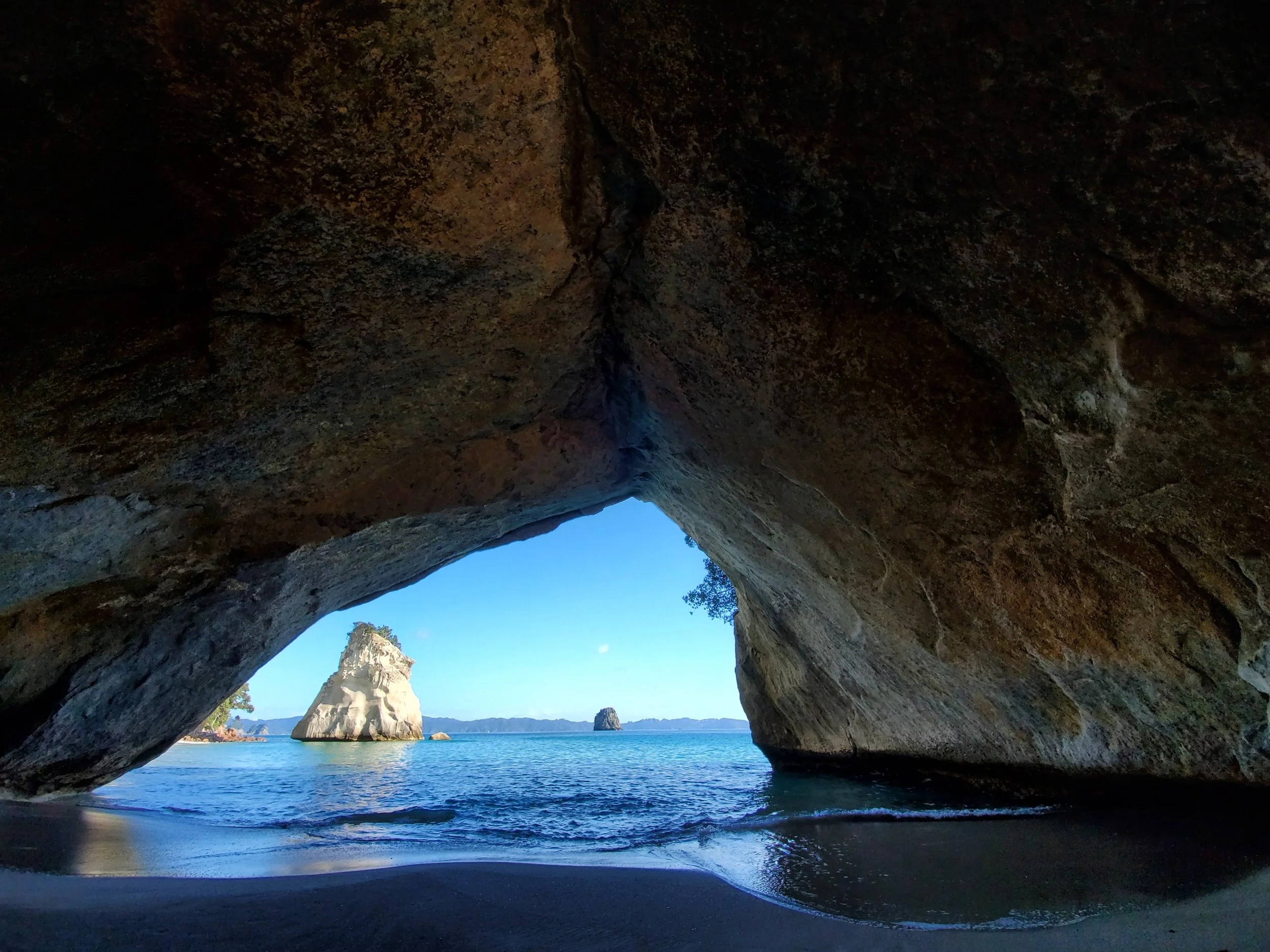
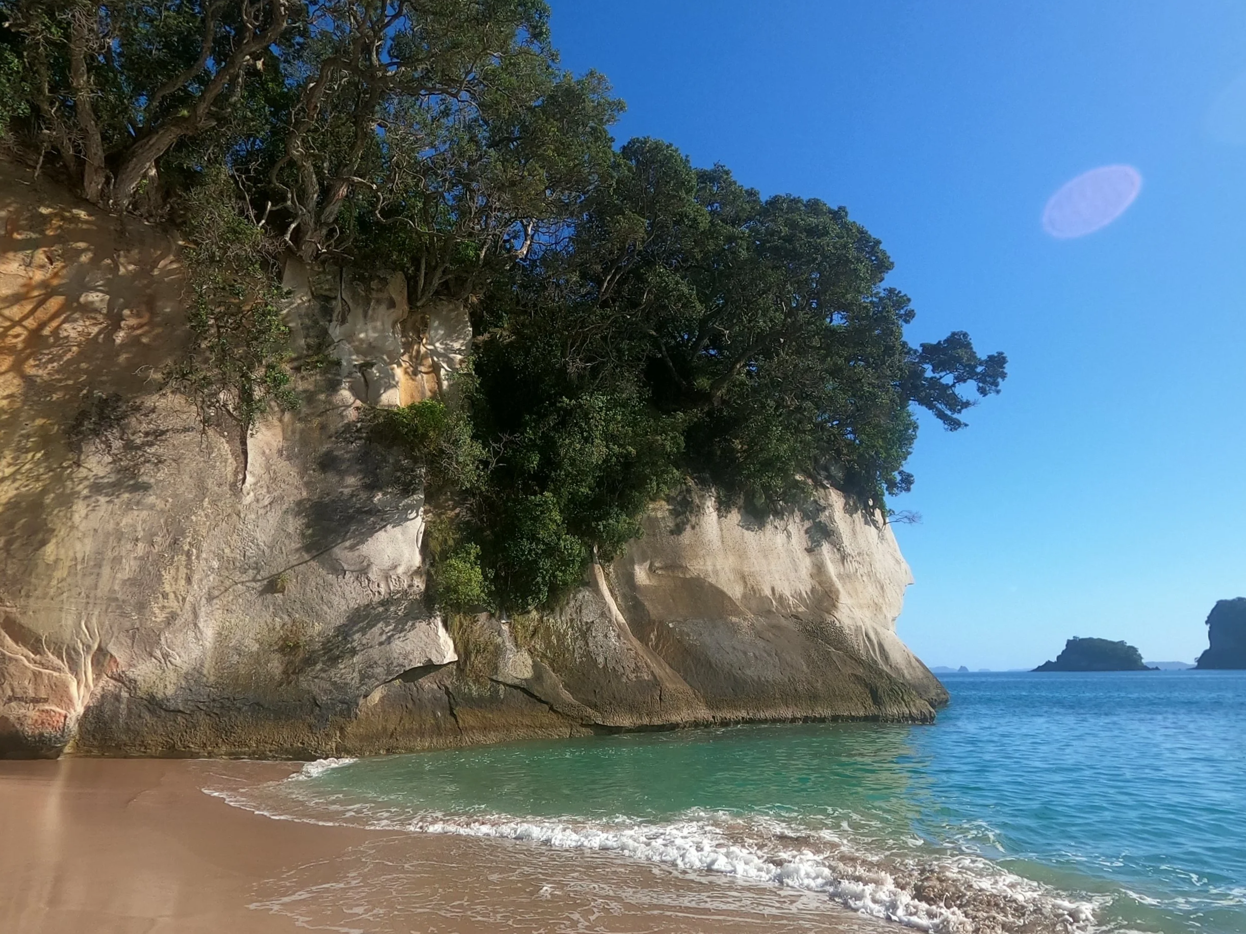
Cathedral Cove
Time: 2.5 hour return
Difficulty: moderate
Type: out-and-back
Distance: 7.2 kilometres
Elevation Gain: 264 metres
The path from the carpark in Hahei is incredibly well-maintained and paved for the bulk of the journey, making it accessible to most visitors. There are stairs at the end of the path leading down to the beach where Cathedral Cove can be found .
Along the way there are endless views, but the main event is the famous natural cave that frames the landscape beyond it. Bring a swimsuit and dip into the ocean while you enjoy the scenery before heading back.
Huka Falls via Spa Park
Time: 2 hour return
Difficulty: moderate
Type: out-and-back
Distance: 6.8 kilometres
Elevation Gain: 175 metres
Set off from the carpark for the natural hot springs on the east side of the river and follow the paved path along the river’s edge. Though the path is in good condition, it is not flat with a lot of short ups and downs.
When you arrive at Huka Falls, enjoy the bright blue rushing waters. Consider soaking in the thermal spas on your return to soothe the muscles for a while!
If you’d prefer a more natural path, there is another on the west side of the water that cuts through a redwood forest and also leads to the falls.
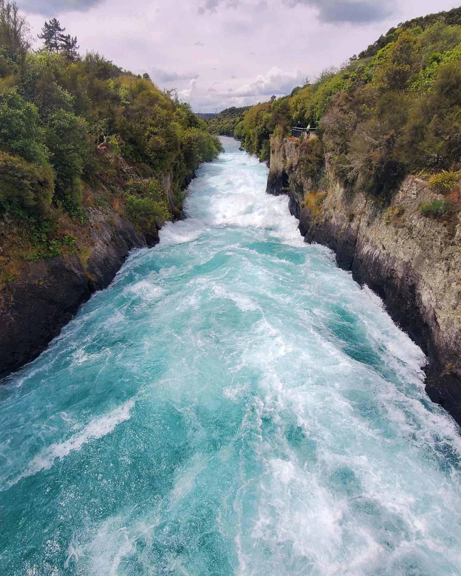
Walking to Huka Falls
Tongariro Crossing*
Time: 6-8 hour one way
Difficulty: difficult
Type: point-to-point
Distance: 20 kilometres
Elevation Gain: 853 metres
“One does not simply walk into Mordor”… unless of course you choose to tackle the Tongariro Crossing!
The Crossing is a point-to-point hike and therefore requires a relocation plan unless you intend to only complete it partway, treating it as an out-and-back. The north trailhead can be found at Lake Rotoaira, while the south-eastern one is near Mandatepopo Valley. Shuttle services are available; information can be found here on Pure New Zealand. It is recommended to book the shuttle in advance to guarantee a spot.
Weather can drastically change the conditions of the trai, I would strongly recommend following the advisories.
Red Rocks Coastal Walk
Red Rocks Coastal Walk
Time: 2 hour return
Difficulty: moderate
Type: out-and-back
Distance: 7.6 kilometres
Elevation Gain: 136 metres
A short drive out of Wellington is Owhiro Bay, where you will find a path leading out of the carpark and along the coast. The path is a little rocky and uneven, but has minimal elevation change. About an hour into the walk you will arrive at Red Rocks. The area is known for being a good place to spot seals lying on the rocks, enjoying the sun.
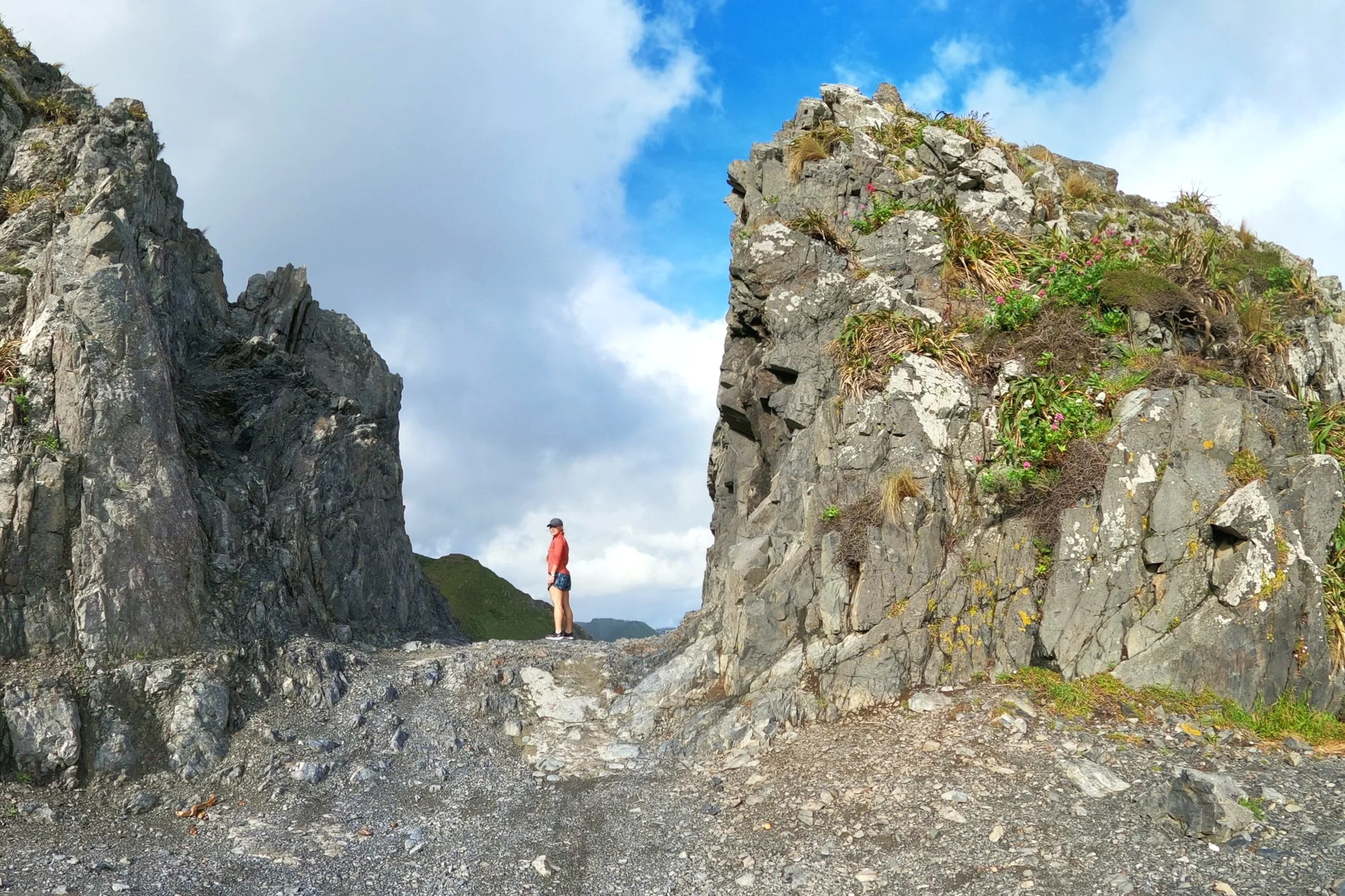
St Paul’s Rock*
Time: 1 hour return
Difficulty: moderate
Type: out-and-back
Distance: 1.1 kilometres
Elevation Gain: 100 metres
If you’re making your way up to Cape Reinga, consider making a stop to stretch your legs with the short climb up St Paul’s Rock. It’s known as being a local favourite, rather than amongst tourists, perhaps due to it being so far from the beaten path. From the peak, there are 360-degree views of the bay and the surrounding landscape.