Hiking in New York’s Adirondack Mountains
visited: oct 2023At the beginning of October 2023, my best friend Andie, her dog Juno, and I took a road trip to the Adirondack Mountains in New York state for a quick but incredible backcountry camping and hiking trip. We decided to visit the High Peaks Wilderness area to begin our journey toward joining the 46ers — a community of hikers who have climbed all 46 summits over 4,000 feet (1,219 metres).
Originally, we planned to spend six days in the High Peaks, ticking off about ten of the 46 peaks. Sadly, as anyone who has spent time in the mountains knows, weather can be unpredictable, and it took a turn — with extreme rainfall and temperature drops that we were not properly prepared for, we decided to pack up after three days.
We made the most of our time, though, summiting six of the peaks. Adirondacks, I will be back!
→ New to hiking? Start here: Hiking 101. Learn how to choose trails, hiking terms, and what to pack (without overdoing it).
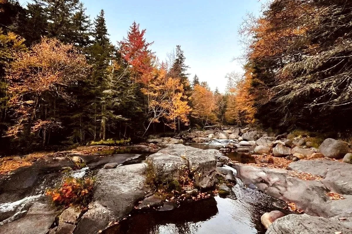
Fall foliage lining a stream in the High Peaks Wilderness
→ New to hiking? Start here: Hiking 101. Learn how to choose trails, hiking terms, and what to pack (without overdoing it).
Day 1: Lower/Upper Wolfjaw, Armstrong & Gothics
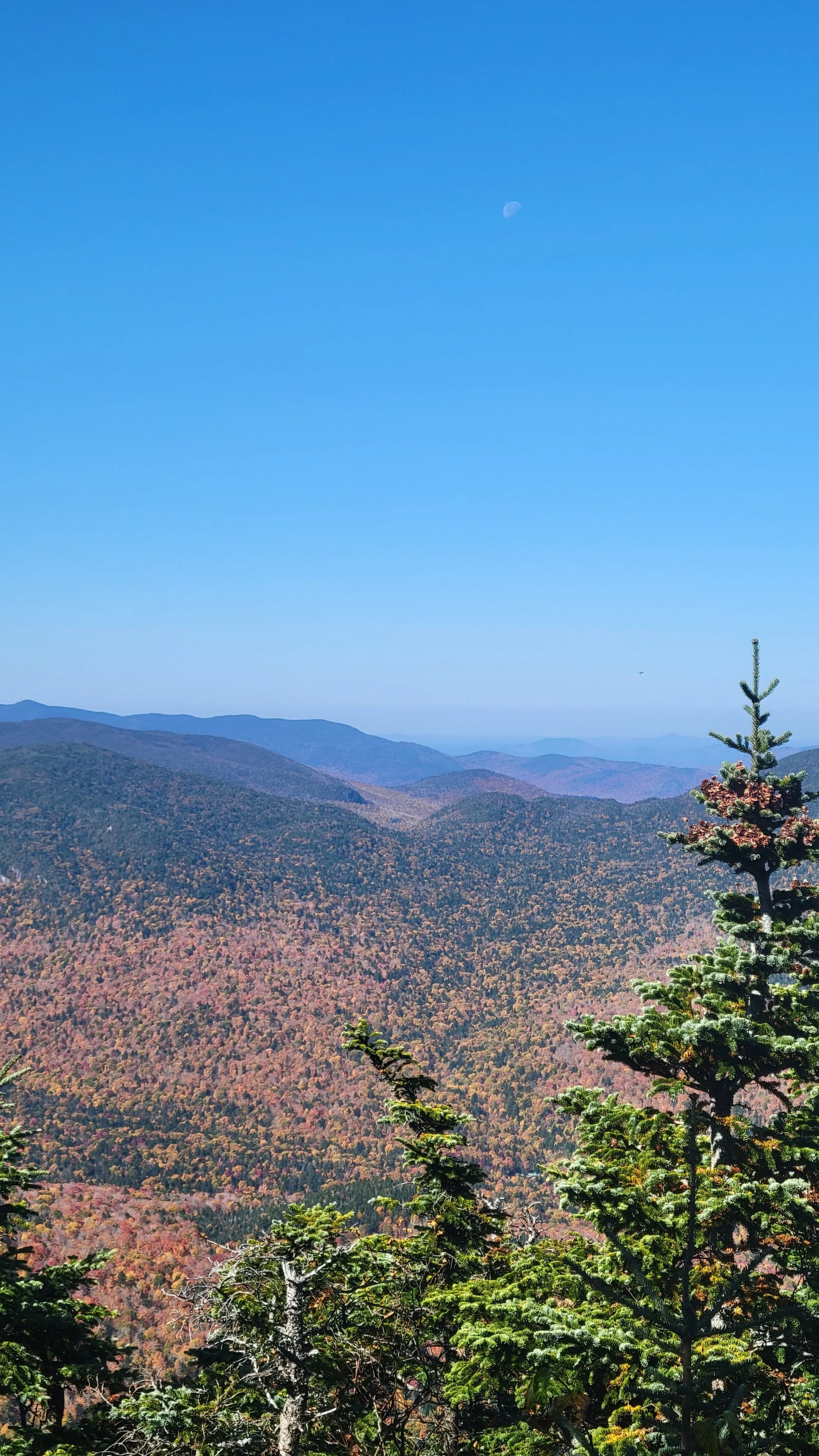
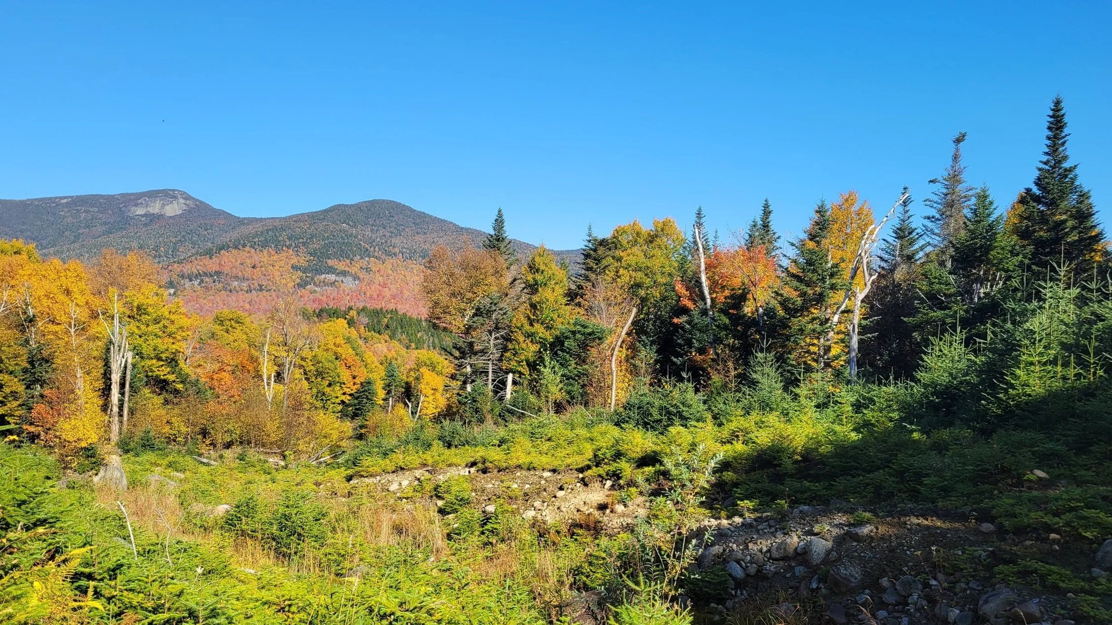
Adirondacks in the fall
We started from the Garden Trailhead parking lot before sunrise. This lot is a popular access point for the High Peaks Wilderness, so starting early was a must. We set out for our chosen campsite, which was located about 200 metres (72 ft) past Johns Brook Lodge (JBL), a popular backcountry lodge 5.5 kilometres (3.4 mi) in from the Garden Trailhead. We decided a basecamp would be best for our trip, so we pitched our tent, placed our bear canister, loaded up our day packs, and set off to hike some mountains.
Choosing to tackle the Upper/Lower Wolfjaw, Armstrong and Gothic loop, we backtracked to JBL to begin, and departed at 10:30 am. Following Woodsfall Trail until it connected with Wolfjaw Trail, we chose to do the loop clockwise.
Heading up to the notch is a steady, but relatively gentle, incline, climbing only about 400 metres (1,312 ft) in three kilometres (1.8 mi). When we reached the notch, we went left, following signs for Lower Wolfjaw (1,272.5 m/4,175 ft). After this turn, the path gets more demanding, climbing 200 metres (656 ft) in a quick half kilometre (0.3 mi). At the summit, we were rewarded with colourful views of the changing leaves in the valleys below, conquering our first peak of the 46ers! The journey to the top from JBL took just under an hour and a half, and we arrived by 12:00 pm.
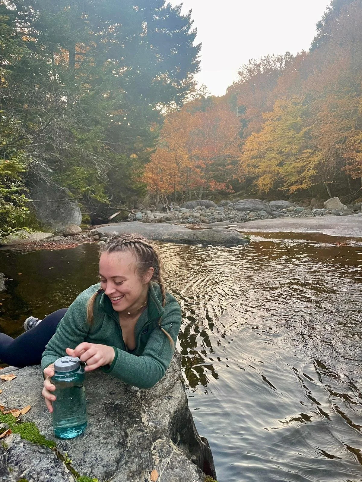
Filling water bottles in the river near JBL
After taking a break to refuel and rest we scurried back down to the split in the trail to continue along the other direction to Upper Wolfjaw. Before beginning our second summit we tacked on a side quest, backtracking downhill to refill our water stores in a stream we had passed on our way up, adding an hour to our hike. I may or may not have slipped and fallen into the stream while doing so, but no hikers were harmed in the process.
Returning to the fork, we carried on, this time following the signs for Upper Wolfjaw (1,281 m/4,203 ft). The ascent from here is slightly more difficult than the climb up to Lower Wolfjaw, due to changes in terrain. I’ve heard it can be quite slippery depending on weather conditions, so make sure to take it slowly and have good tread on your boots. It is not an easy trail by any means — especially if you’re short like us — so come prepared to put in the work. Continuing toward Upper Wolfjaw and beyond, there is no shortage of obstacles, including steep rock faces, ladders and cables. I should also mention we did not see any other dogs on this trail and received multiple comments on how impressive she was in her abilities, so keep in mind this is not recommended for pets.
Lower and Upper Wolfjaw summits are about two kilometres (1.2 mi) apart without the water detour, and we made it at 2:30 pm. After arriving at our second peak, we decided we would continue to Armstrong and Gothics. Following the circuit clockwise like we did, the descent from Gothics includes cables bolted into the rock to help with the steep, exposed section near the summit — not exactly something we wanted to tackle with a dog in the dark. Sunset in early October is around 6:30, which we hoped was enough time to accomplish it. We carried on, planning to reevaluate if necessary when we arrived at the next summit.
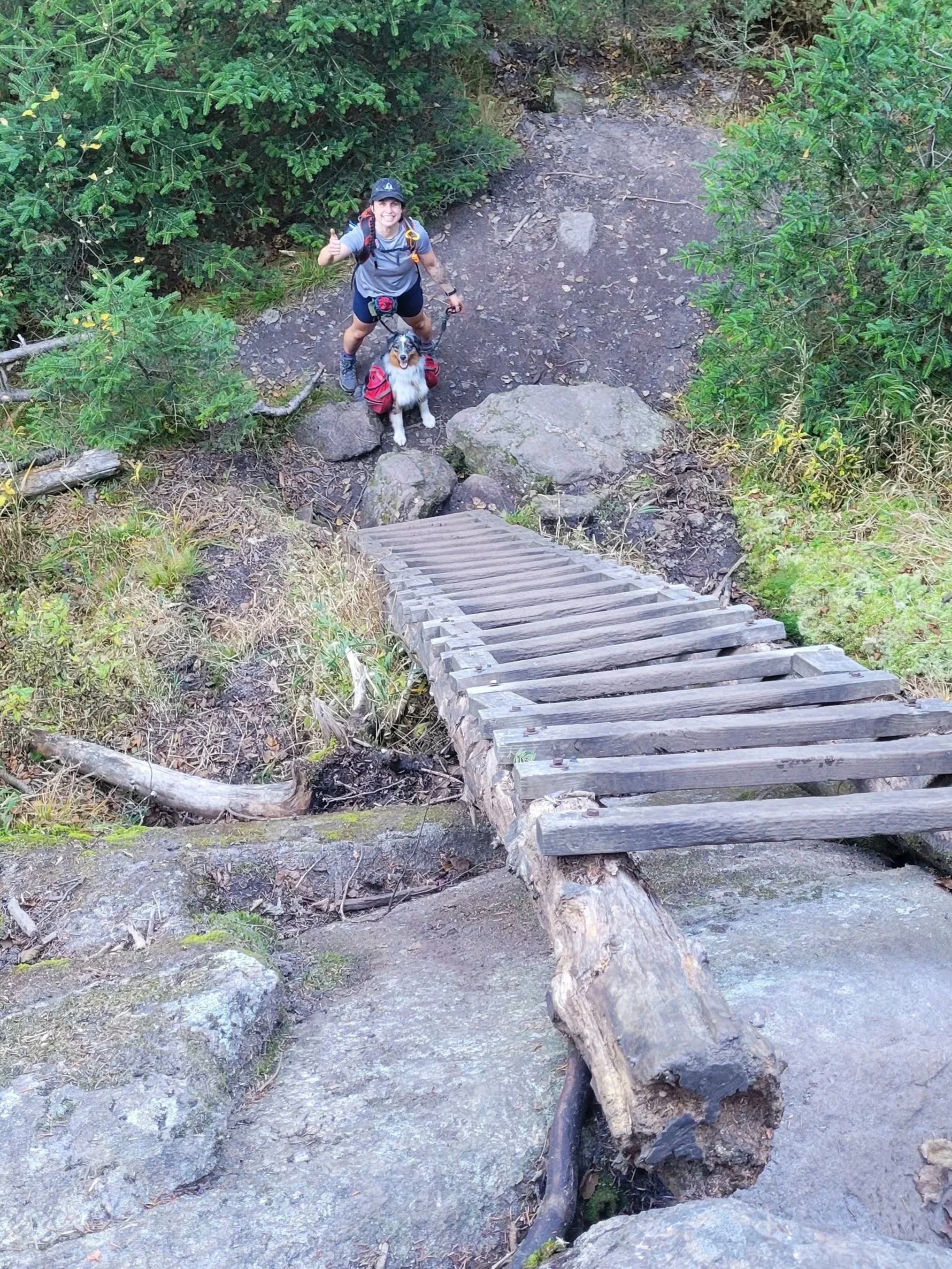
Ladder obstacle on the path to Armstrong
On the route up to Armstrong (1,344 m/4,410 ft), we scaled ladders and steep rock faces, putting our and Juno’s skills to the test. Despite the obstacles, we reached our third peak by 4:00 pm, treated to panoramic views painted by the brilliant colours of the fall foliage. With about two and a half hours remaining, we refuelled with some trail snacks and confidently continued to the fourth and final summit of day one.
The trail between Armstrong and Gothics continued in a similar fashion with steep ups and downs, with a final half-kilometre (0.3 mi) inclined push to the summit. Arriving at Gothics (1,443.5 m/4,736 ft) just after 5:00 pm, we reached the highest peak of the day. Following the circuit in this direction meant we ended with the most incredible views after a job well done. Scaling down the cables with a dog was a slow process, but we managed without too much difficulty. Our timing was perfect as we had just enough daylight to complete the worst of the descent before the sun set. We finished the last couple of kilometres in the dark, using our headlamps to guide us, and nervously rambling loudly enough to keep the bears away.
We made it back to camp, cooked a light dinner in the woods, huddled over our camp stove, and crashed — absolutely exhausted — after nearly 20 kilometres (12.4 mi) since sunrise.
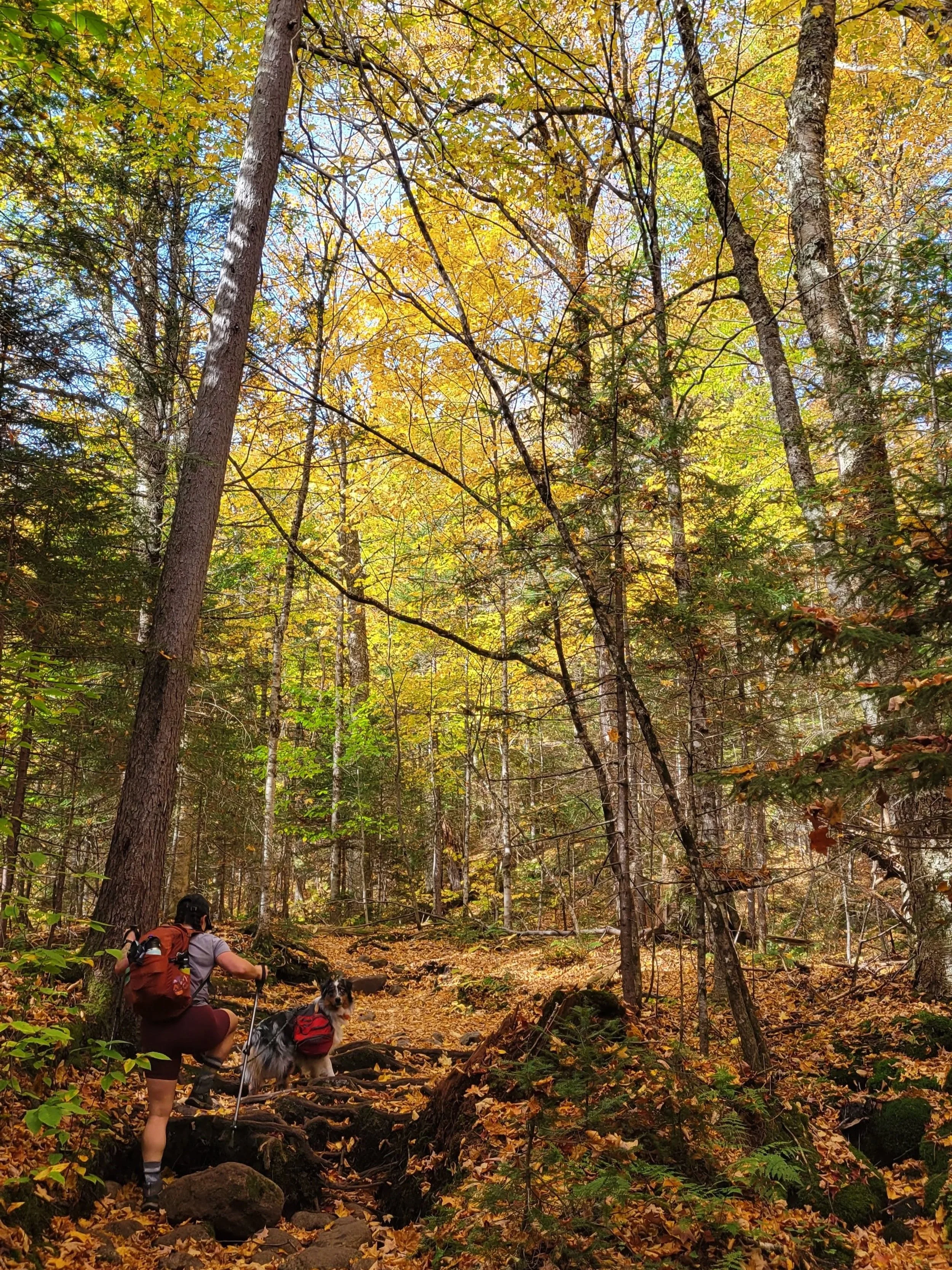
Andie and Juno hiking the leaf-covered trails
Day 2: Mount Marcy
Unlike day one, we had our sights on only one peak, albeit the tallest one: Mount Marcy (1,628 m/5,344 ft). Enjoying a slower morning, we slept in, enjoying the quiet of the forest and hit the trail around 10:30 am.
We followed Phelps Trail alongside Johns Brook until the cutoff for Hopkins Trail, which we opted to take on the ascent for a more gradual climb to the top than Phelps. The path was overgrown, marshy and rocky, but easy to follow and stay on course nonetheless. As we rounded Little Marcy and turned onto Van Hoevenburg Trail, the trail levelled and was clearly more maintained — a nice reprieve before the final ascent began up to Mount Marcy’s summit after the junction where it meets with Phelps Trail again.
The final stretch, winding its way through alpine shrubs and over large rocks, absolutely destroyed our legs. It’s marked with cairns and paint blazes on the rock face, so keep an eye out and stay on the path.
Arriving at the summit shortly before 3:00 pm, we were rewarded with absolutely incredible 360-degree views and nippy winds. Posting up behind a boulder to stay out of the brunt of the winds, we fired up our camp stove and enjoyed a hot lunch while taking in the view from our fifth peak in two days. Not too shabby if I do say so myself.
For our descent, we followed Phelps Trail instead. Climbing down what seemed to be a dried-up riverbed, with mud visible between the large rocks we navigated over. I truly can’t decide if we made the right call — I think my thighs were quaking the entire way down — or if I would have preferred to do the opposite route, climbing up the rocks instead. But I think either would have been difficult in its own regard, so pick your poison!
Once we came back to the junction where it branches for Hopkins Trail, the way felt comparably easy and we headed back to camp for the evening, wrapping up our day by 6:00 pm, after hiking nearly 16 kilometres (9.9 mi) on our loop.
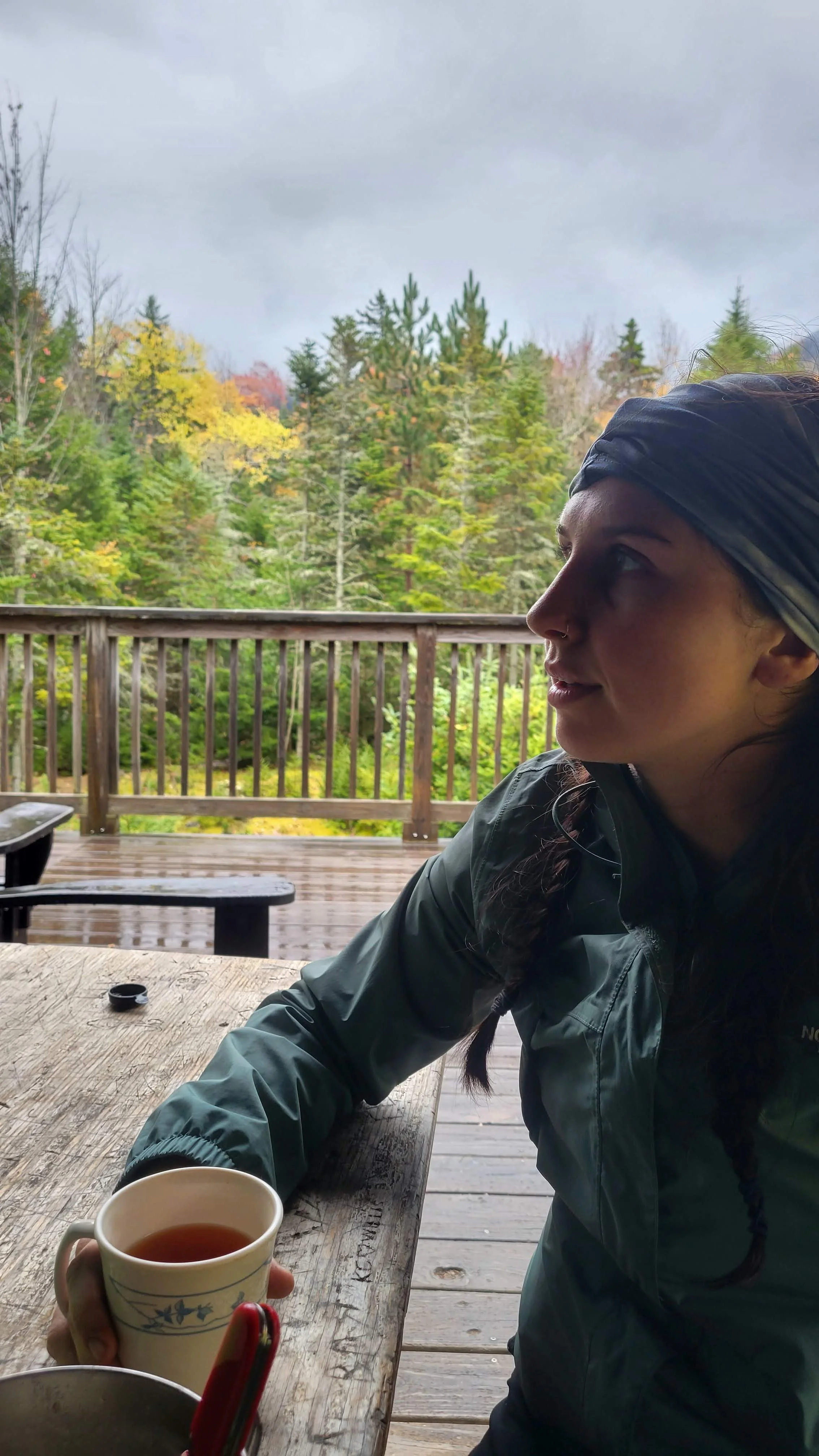
Enjoying a cup of tea and our lunch at JBL
Day 3: Big Slide & Yard
Waking to the sound of rain hitting our tent, we realized our hopes to catch sunrise from our sixth summit, might be dashed. Regardless of the forecast we got up and on the trail before 5:00 am, on the off chance the rain gods were on our side. With headlamps on, we headed out of camp past JBL to the turn off from Phelps Trail to Big Slide Trail. Aptly named, Big Slide Trail is largely a smooth rock face that is not exactly easy to walk up, especially in the rain… oops! Trudging up, trying not to slide down, half asleep and shivering in the cooler air, I began to notice the toll of the past two days of hiking on my legs. I needed frequent rests on the way up as my thighs were burning with every step. Note to self: stretch more.
When we finally made it to the top, our view was one of thick grey clouds, but we had reached our sixth High Peak, Big Slide Mountain (1,292 m/4,240 ft) and were feeling extremely proud of ourselves! We paused to have breakfast in the cover of the trees, then continued under the canopy for about 2.5 kilometres (1.5 mi) to the Yard Mountain summit. Though Yard is over 4,000 feet, it doesn’t count as one of the High Peaks because it is too close to Big Slide and is considered to be more of a ridge than a separate mountain. So, though it’s not counting for the 46ers, we’ll say this was summit number 6.5.
We descended following Yard Mountain Trail to its intersection with Klondike Notch Trail and followed signs for JBL. Arriving back at JBL by 11:30 am, we completed the 10 kilometre (6.2 mi) loop before lunch. Not a bad morning!
While we were at the top of the mountain, we were able to get some spotty service and checked the forecast, discovering that the rain and cooler temps were supposed to continue the remainder of the week, with possible snow during the nights. Because we weren’t properly prepared for those conditions, we made the choice to pack up early and end the adventure on a high note.
We cooked up lunch sitting on the deck at JBL, purchased hot teas from inside and enjoyed a last meal before packing up camp and beginning our hike back out to the Garden Trailhead lot.
Even though the trip was cut short, it couldn’t have been more memorable — a welcome reminder to unplug and enjoy nature.
High Peaks Wilderness